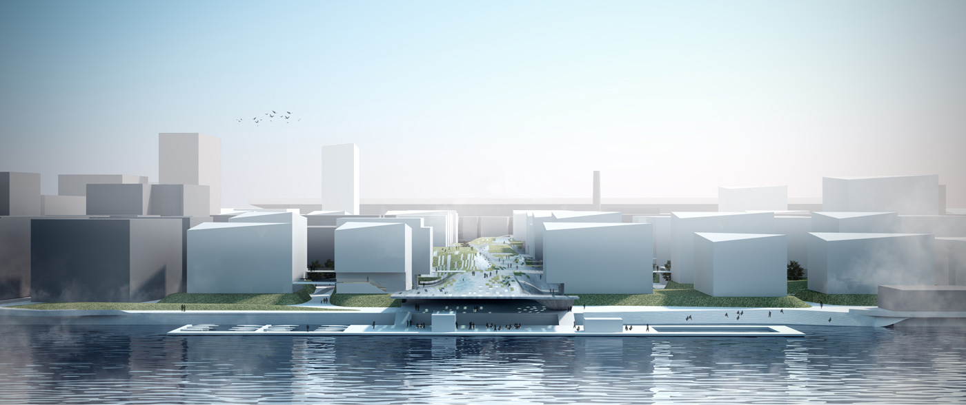
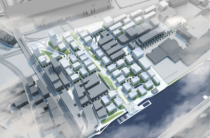
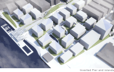
|

Inverted Pier

 
Boston Living with Water  
 
Info:
Boston Living with Water
 
Kunde:
The Boston Harbor Association,
City of Boston,
Boston Redevelopment Authority
Boston Society of Architects
 
Standort: 
Boston, USA
 
Typus:
Masterplan
 
Status:
Wettbewerb (2015)
 
Fläche:
217.000m² (53,6 acre)
 
Renderings:
studiohometown (studiohometown.de)


INVERTED PIER
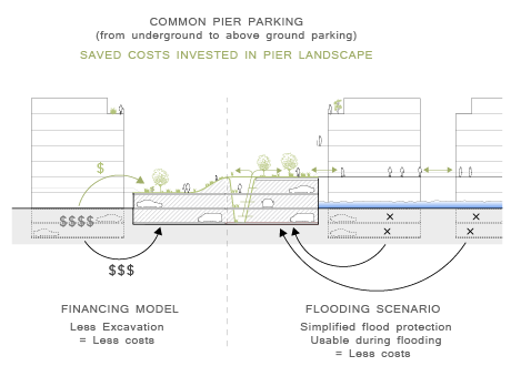
The Boston waterfront is characterized by an artificial border dominated by piers. Piers represent a structure built to enlarge the coast-line which is resistant against tides and extreme weather. The design for the 100 Acres Master Plan uses the advantages of this structure and develops it further by creating a land pier - a so-called INVERTED PIER.It makes the site resistant to the predicted end-of-century Sea Level Rise of approx. 5ft (1,52m) accompanied by an increasing chronic and episodic coastal flooding of approx. 18.5ft (5,64m) on the Boston City Base (BCB).
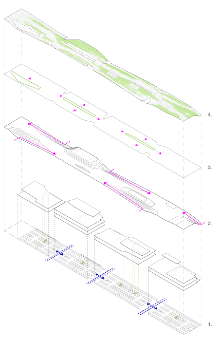
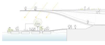
The INVERTED PIER is positioned in the center of the site connecting the waterfront with the convention center in the south-east. It functions as backbone of the site by providing approx. 4000 parking spaces on 3-4 levels creating a walkable roof top landscape of 20-37ft (6-11m) above ground (height of 30-47ft BCB).
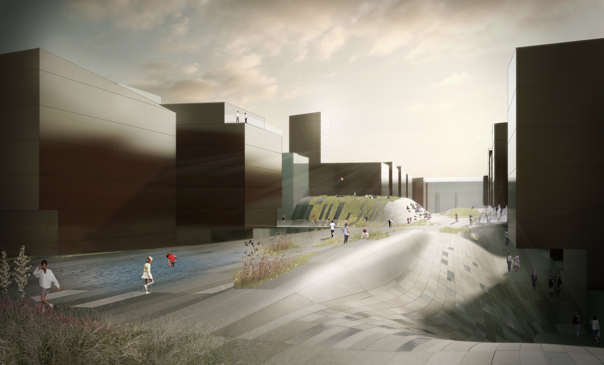
The pier offers a common ground designed as multifunctional landscape with recreation areas, community gardens, jogging routes and sports grounds as well as an area for open air screenings with cafes and restaurants. It functions as center of the neighborhood where the inhabitants can park their cars, meet on the pier landscape and access their direct surrounding by foot. Thus forming the basis for a lively, active and communicative neighborhood.

FLOOD PROTECTION
1.The site has a base level of 8ft - 13ft. To ensure protection from the 100-year Storm Surge (approx. 10ft BCB) the site will be filled up in areas that fall below 10ft with excavation of the car park together with additional soil (max. 2ft).
2.In case of a storm surge higher than the 100-year Storm Surge (10ft) the INVERTED PIER keeps the neighborhood fully functional. With two elevated access points from outside it constitutes the central hub from which the surrounding buildings can be reached via bridges.
3.The buildings themselves are positioned within a three-dimensional shaped landscape forming islands with a minimum height of 8.5ft (+ base level = 18,5ft). The islands give additional stability to the buildings in case of storm surge as well as protection against flooding.

ECOLOGICAL FEATURES
To mitigate adverse building impact on the environment the roofs are covered with solar heat panels as well as photovoltaic panels. To raise the efficiency of the panels the roofs are inclined and positioned in an optimum angle to face the sun both horizontally and vertically.
Between the landscape islands the surface water of the surrounding buildings is collected in artificial troughs. After heavy rains the rainwater will be held in the troughs until the water system regains enough capacity. Water gets enjoyable and is experienced as integral part of infrastructure.